Source: EBRPD
Father’s Day themed activities Sunday, June 16; Juneteenth Free Park Day Wednesday, June 19
By Flora Csontos Acting Public Information Specialist, Public Affairs, East Bay Regional Park District
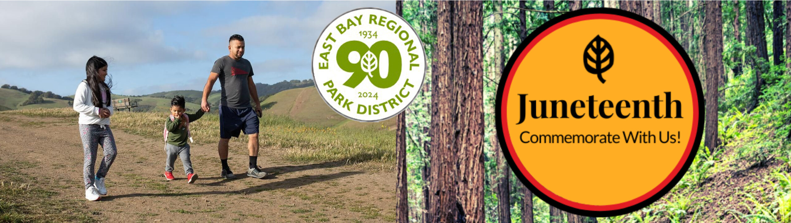
Thank you to the estimated 6,000 attendees who celebrated the East Bay Regional Park District’s 90th Anniversary at ParkFest at Lake Chabot Regional Park on May 11 and enjoyed a fun event filled with music, performances, food, and more. What a great time celebrating nearly a century of preserving open space and providing East Bay residents with access to nature close to home. Join us for more fun events throughout the year celebrating 90 years of East Bay Regional Parks, including “Explore Your Parks” programs, festivals, story sessions, picnics, and much more. For more information, visit www.ebparks.org/celebrating-90-years.
––––––––––
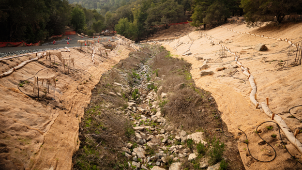
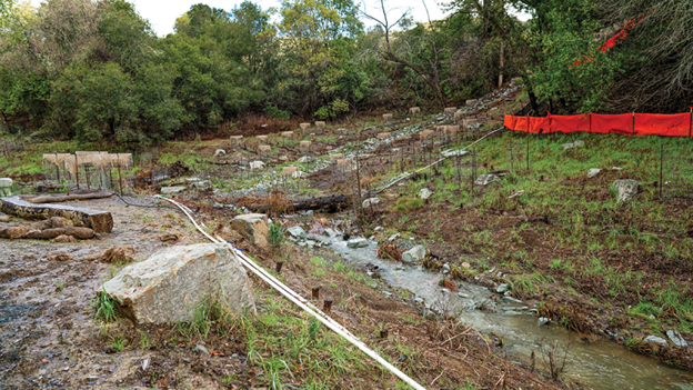
The largest creek restoration project in the Park District’s history was recently completed at Sibley Volcanic Regional Preserve, which removed several culverts and opened up 3,000 feet of creek to a more natural run. It is also the largest creek daylighting project in the entire Bay Area.
The Alder and Leatherwood Creek Restoration and Public Access Project, previously referred to as the McCosker Project, provides natural habitat for special status or protected species, including the California red-legged frog, California foothill yellow-legged frog, Alameda whipsnake, San Francisco dusky-footed wood rat, golden eagle, Cooper’s hawk, loggerhead shrike, northern harrier, and white-tailed kite. Water quality and streamflow were also improved by the project, providing new habitat for rainbow trout.
The project was made possible through $4 million in funding secured by Assemblymember Rebecca Bauer-Kahan in the 2019 state budget. Additional funding came from the Park District’s voter-approved Measure WW and other state and federal grants from the U.S. Environmental Protection Agency, Wildlife Conservation Board, Coastal Conservancy, California State Parks, and voter-approved Propositions 1, 84, and 50 allocated by the California Natural Resources Agency.
For more information, visit www.ebparks.org/about-us/whats-new/news/park-district-celebrates-grand-opening-alder-creek-and-leatherwood-creek.
––––––––––
Park District launches pilot program to streamline entry at Del Valle Regional Park. East Bay Regional Park District began a new pilot project on Memorial Day weekend to expedite park entry at Del Valle on weekends and holidays. Entry to Del Valle Regional Park on busy weekends and holidays can be very challenging as visitors line up at the entry kiosk to pay for park admission and parking. With the pilot project, visitors will pay a single $10 flat fee to enter the park rather than individual fees based on park use. The $10 flat fee covers park parking, trailers, and dogs. Fishing and quagga inspection fees can be purchased at the marina area. The $10 flat fee does not apply to Regional Parks Foundation members, who receive free park entry/parking at all Regional Parks as part of membership benefits. To help expedite entry, a limited number of passes will also be available for pre-purchase online at www.ebparks.org/parks/del-valle/pre-purchase-parking. As vehicles approach the kiosk, there will be a separate line for pre-paid parking, staff, members, and residents. For up-to-date information or to provide feedback, visit www.ebparks.org/parks/del-valle.
––––––––––
Join the Park District to celebrate Juneteenth on June 19. The Park District is celebrating Juneteenth with a Free Park Day and special naturalist-led programs on Wednesday, June 19, which is a state and federal holiday. All are welcome! Juneteenth is the oldest nationally celebrated commemoration of the ending of slavery in the United States. Join the Park District to celebrate and reflect. For more information, visit https://www.ebparks.org/we-celebrate/juneteenth.
––––––––––
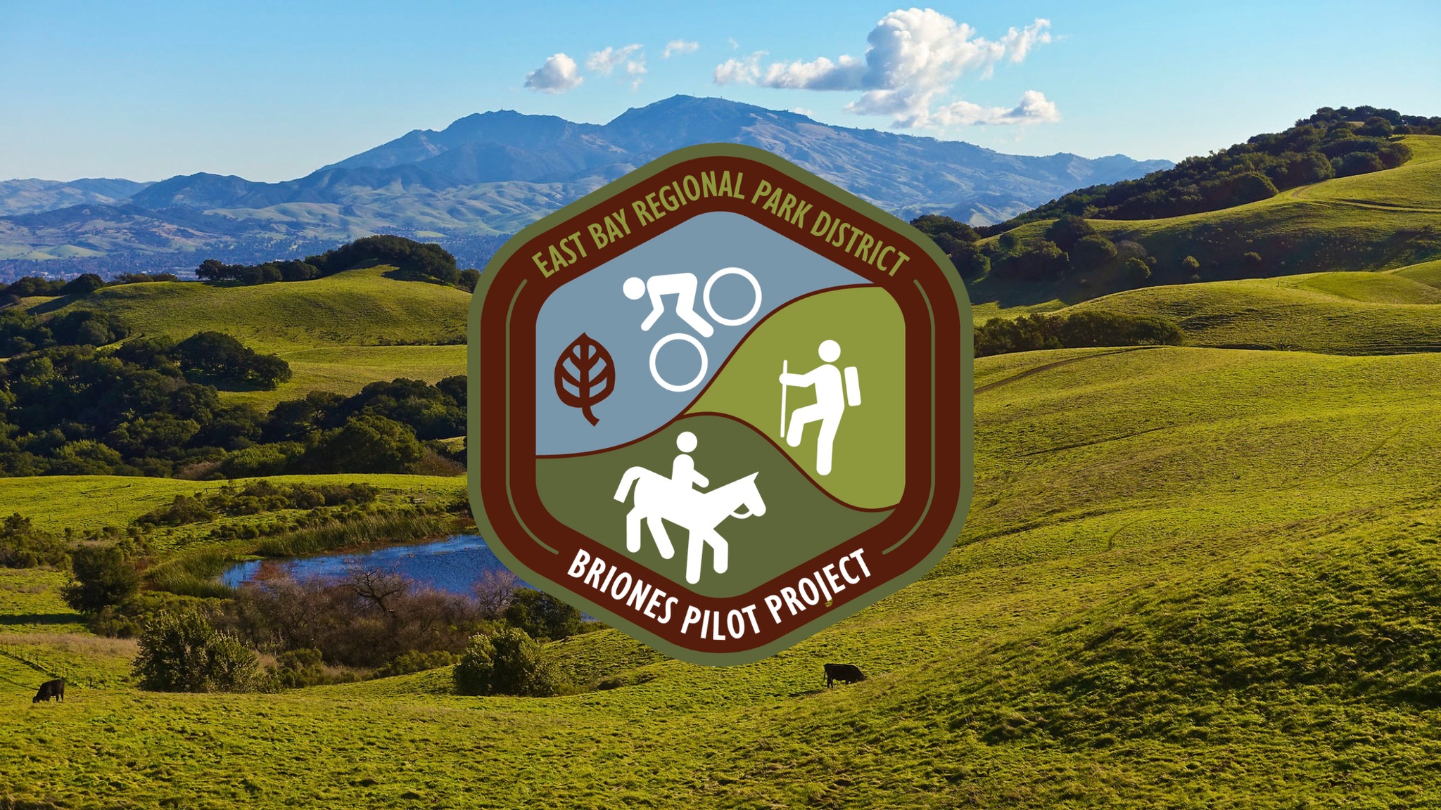
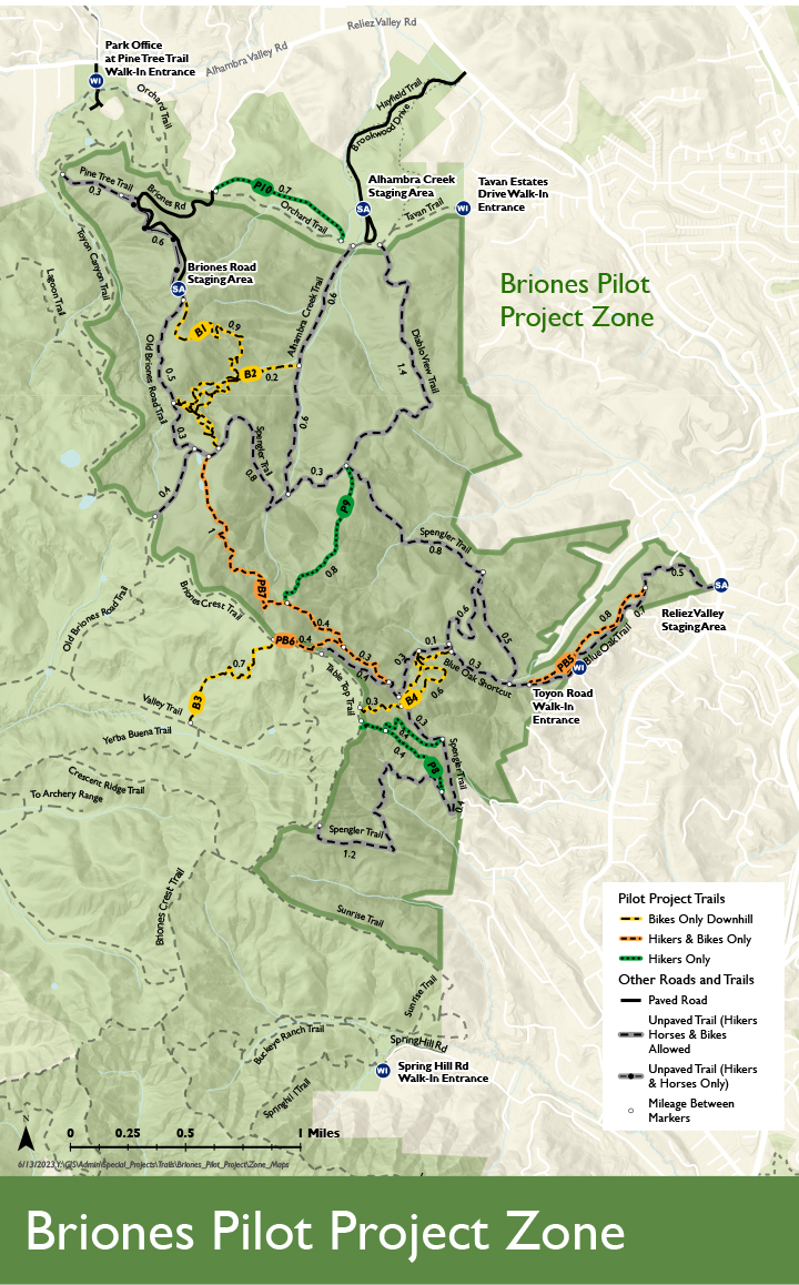
A community meeting for the Briones Pilot Project on June 15 will share feedback on the progress made in the past year and what’s ahead for the project in its second year. The meeting is a chance for attendees to share their views on the pilot project, too. The in-person meeting will be held on Saturday, June 15, at 10 a.m. at the Alhambra Creek Staging Area of Briones Regional Park in Martinez. The Briones Pilot Project is a two-year project created to test new ways to safely share trails amongst bikers, hikers, and equestrians. The project also improves the trail experience for all users while protecting habitat, wildlife, and watersheds. For more information, visit www.ebparks.org/Briones-Pilot-Project.
––––––––––
Enjoy Father’s Day at the East Bay Regional Park on June 16. Celebrate Father’s Day in nature or check out one of the themed activities planned in Regional Parks: Anthony Chabot Campfire: WILD Dads! at 8 p.m. at Anthony Chabot Family Campground, Father’s Day Celebration at 11 a.m. at the Doug Siden Visitor Center at Crab Cove, or Father’s Day Family Hike at 1:30 p.m. at Del Valle. For more information, visit www.ebparks.org/calendar?terms=Father’s+Day.
––––––––––
Celebrate Regional Parks at Lakeside Laps on July 20. Mark East Bay Regional Park District’s 90th and the Regional Parks Foundation’s 55th Anniversary with a 5k, 10k, or half marathon at Lake Chabot Regional Park in Castro Valley. The Regional Parks Foundation event is a fundraiser supporting East Bay Regional Parks. Come celebrate wellness, community, and the beauty of the Regional Parks while enjoying a run along the lake. For more information, visit www.regionalparksfoundation.org/news-events/lakeside-laps.
The East Bay Regional Park District is the largest regional park system in the nation, comprising 73 parks, 55 miles of shoreline, and over 1,330 miles of trails for hiking, biking, horseback riding, and environmental education. The Park District receives an estimated 30 million visits annually throughout Alameda and Contra Costa counties in the San Francisco Bay Area.