• Home
  • About The Herald
  • Local Agencies
  • Daily Email Update
  • Legal Notices
  • Classified Ads

Contra Costa Herald

News Of By and For The People of Contra Costa County, California

  • Arts & Entertainment
  • Business
  • Community
  • Crime
  • Dining
  • Education
  • Faith
  • Health
  • News
  • Politics & Elections
  • Real Estate

Max Korten promoted to East Bay Regional Park District General Manager

August 4, 2026 By Publisher Leave a Comment

Brings proven record of securing park funding, protecting land, and expanding public access

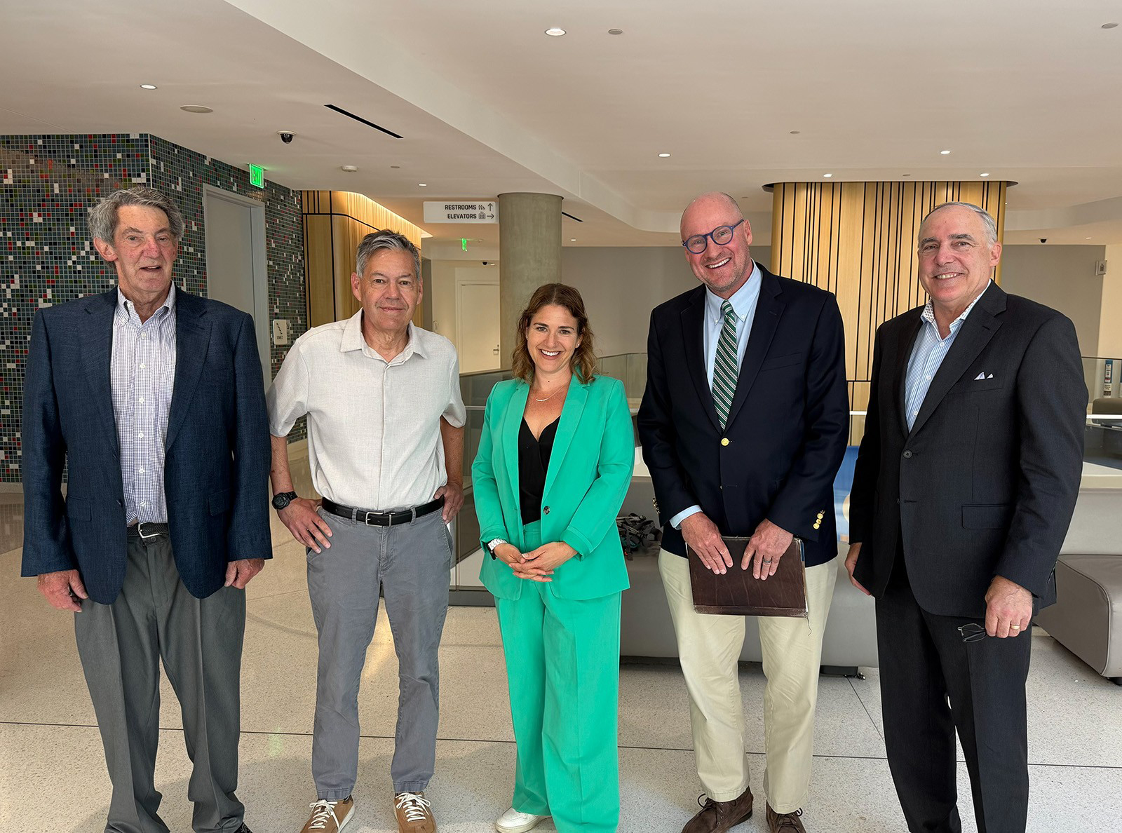
New General Manager Max Korten. Photo: EBRPD

OAKLAND, Calif. – Twenty-seven years ago, Max Korten was a young ranger in the Sierra Nevada, leading campfire talks for the U.S. Forest Service. Today, Tuesday, August 4, 2026, the East Bay Regional Park District Board of Directors voted 6-0 to appoint him General Manager, putting him at the helm of one of the largest regional park systems in the country. Korten has served as Acting General Manager since November 2025.

“Max has demonstrated steady, thoughtful leadership and a deep commitment to the East Bay Regional Park District’s mission, employees, and the communities we serve,” said Olivia Sanwong, president of the Board of Directors and representative for Ward 5. “The Board is confident that his experience, collaborative approach, and clear vision will guide the Park District forward as we expand access to nature, preserve our rich heritage of natural and cultural resources, provide meaningful environmental education, and ensure that an environmental ethic continues to guide all that we do. We are pleased to appoint him as general manager and look forward to continuing our work together.”

Korten joined the Park District as Deputy General Manager in October 2024. From the start, he worked closely with teams across the District to resolve challenges and build a more cohesive organization. Korten has worked diligently to build trust between the Board and staff through increased communication, transparency, and engagement. His accomplishments include collaborating with union leaders to reach an agreement on a new telework policy and working with neighboring city officials to preserve the historic Flag Barn in Brentwood. Korten is currently supporting staff and partners in efforts to reduce traffic on Del Valle Road in Livermore and is working with the Trust for Public Land, state leaders, and the cities of Berkeley and Albany on the potential acquisition of Golden Gate Fields.

Before joining the Park District, Korten spent 10 years at Marin County Parks, the last eight as director and general manager, leading an agency responsible for 34 open space preserves, 45 parks, and about 150 employees on a $35 million annual operating budget. He reported directly to the Marin County Board of Supervisors and worked with nine commissions and board-appointed committees.

During his tenure at Marin County Parks, Korten led the passage of the 2022 renewal of Measure A, the countywide sales tax that funds park maintenance, wildfire fuel reduction, farmland preservation, and public access, winning voter approval by about 75%. He also worked to eliminate park entrance fees, an initiative that aimed to expand equitable public access. He was also successful in passing a $20 million acquisition bond measure.

Looking ahead, Korten has prioritized aligning the Park District’s fire, stewardship, and operations teams around a cohesive vegetation management strategy. The effort includes mapping wildfire risk and habitat opportunities across the Park District for the first time. He is also leading development of District planning to support the Board in establishing shared goals and strategies to guide implementation in the years ahead.

“I’m honored and grateful for this opportunity, and I don’t take it lightly,” Korten said. “The Park District is a special place, and I’ve learned so much from the people who came before me. These parks are meant to be here forever, for everyone, and my focus is on keeping the organization strong so we can protect these resources while making sure they remain accessible and welcoming to all.”

Earlier in his career, Korten served as a wilderness ranger for the U.S. Forest Service, as natural resources program director for Conservation Corps North Bay, and as a backcountry ranger and trail crew supervisor for the Bureau of Land Management.

Korten holds a bachelor’s degree in environmental studies from the University of California, Santa Cruz, and a master’s degree in natural resources from Humboldt State University. He lives with his family in Berkeley, where he is a regular on the trails of Tilden Regional Park.

The East Bay Regional Park District is the largest regional park system in the nation, comprising 73 parks, 55 miles of shoreline, and over 1,330 miles of trails for hiking, biking, horseback riding, and environmental education. The Park District receives an estimated 30 million visits annually throughout Alameda and Contra Costa counties in the San Francisco Bay Area.


Filed Under: East Bay, News, Parks, People

City of Pittsburg to celebrate Central Harbor Park Grand Reopening and Kickoff Party July 26

July 22, 2026 By Publisher Leave a Comment

Over $3.5 million in improvements completed

By Allen D. Payton

The City of Pittsburg invites the community to celebrate the grand reopening of Central Harbor Park with a family-friendly kickoff party on Sunday, July 26, 2026, from 6:30-8:30 p.m.

Central Harbor Park officially reopened to the public on July 1, 2026. The improvements include:

  • New docks and berths — Increasing marina capacity and access.
  • Expanded restrooms, parking and green space — Creating a more welcoming experience for visitors and families.
  • Shoreline stabilization and ADA pathways — Enhancing resilience and accessibility for all.
  • Modernized event facilities — Encouraging year-round gatherings and civic pride.

With over $3.5 million in Sacramento-San Joaquin Delta Conservancy funding, and after years of planning and construction, Pittsburg’s premier waterfront event space is ready for fishing, sunset walks, gatherings and everyday enjoyment of the Delta.

The improvements were made possible with funding support from the Sacramento-San Joaquin Delta Conservancy, a California state agency whose grant funding helped bring this park to life, and the City of Pittsburg’s Waterfront Fund. The City’s Waterfront Fund is funded by lease revenues generated by users of Pittsburg’s granted submerged tidelands.  This is a reinvestment of locally generated non-tax dollars from the private sector, and so far, has totaled over $500,000.

Video screenshots source: City of Pittsburg

Guests will enjoy an evening of community activities along Pittsburg’s beautiful waterfront, including a s’mores experience, fishing demonstration, Public Safety Meet & Greet, DJ, refreshments and a preview of the park’s new event space.

The celebration provides residents and visitors with an opportunity to explore the reopened park, connect with neighbors and local public safety personnel, and learn more about the recreational and event amenities available at Central Harbor Park.

WHAT: Central Harbor Park Grand Reopening and Kickoff Party

WHEN: Sunday, July 26, 2026, 6:30 p.m. to 8:30 p.m.

WHERE: Central Harbor Park, Cutter Avenue off Marina Blvd., Downtown Pittsburg

  • S’mores bar – enjoy classic treats with a waterfront view.
  • Fishing demonstration – learn from local experts.
  • Preview of the new event space – see the upgraded facilities and seating areas.
  • Public Safety Meet & Greet – meet local law enforcement and emergency services.
  • Live DJ – for a festive evening atmosphere.
  • Refreshments – provided throughout the event.

The event is free and open to the public. Families and community members of all ages are encouraged to attend.

Photos: City of Pittsburg

Boat Launch and Fish Cleaning Station Now Open

The public launch ramps are open and the City is happy to bring with it new restrooms and a fish cleaning station, now open daily from 5:00 AM to 8:00 PM. Whether you’re heading out early for a day on the water or wrapping up your evening catch, these launch ramp amenities are available to support your experience.

The Pittsburg Marina harbor and fuel dock is closed on Sundays. For questions contact the Marina Office at (925) 439-4958 or email marina@pittsburgca.gov.

Background

In 2021 and 2022, City staff conducted outreach to local residents, users of the boat launch, and City waterfront event-goers to determine the community’s priorities for the Central Harbor Park and boat launch area.  These facilities, while aged, are well loved and full of recreators every weekend and often throughout the week.  Via online and in-person surveys, a town hall style community meeting at the park, and many interviews at the facility, staff gathered community input resulting in three major observations:

1) The community values and enjoys the Delta access provided by Central Harbor Park and the boat launch facility. Other than youth-centered park features, the park and launch facilities provide ample opportunity to enjoy the Delta and outdoors.

2) Members of the community often feel unsafe in the project area which impacts their visit frequency.

3) Public infrastructure in the project area is old and worn down, discouraging use and dissuading people from bringing family and friends to enjoy the facilities.

On August 19, 2024, the Pittsburg City Council awarded the construction contract for the project to NTK Construction, and construction began in the fall of 2024 following the groundbreaking on Nov. 15th that year.

For more information about the Pittsburg Marina visit www.pittsburgmarina.com.

Toni Baldazo, City of Pittsburg Community Engagement Officer contributed to this report.

Filed Under: Construction, East County, Government, News, Parks, Recreation, The Delta

Tips to safely celebrate America’s 250th Anniversary in California’s State Parks

June 30, 2026 By Publisher 1 Comment

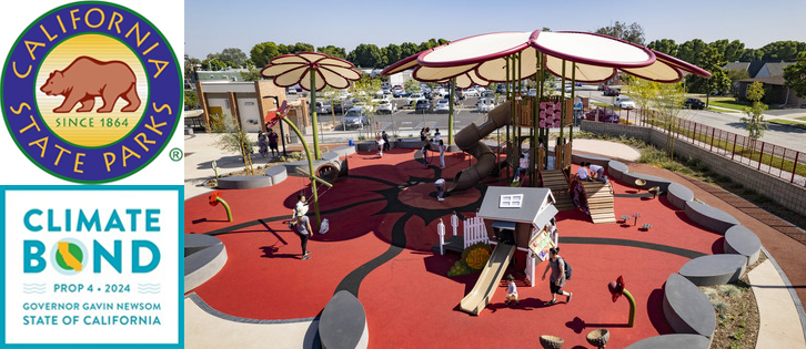
Photo collage: CA State Parks

By CA State Parks

SACRAMENTO — Celebrating America’s 250th anniversary this Fourth of July holiday weekend is the perfect opportunity to have fun in the sun at one of California’s 280 (and growing) state parks. Whether you’re interested in swimming, hiking, boating, recreating in an off-highway vehicle, or watching fireworks over San Francisco Bay, the nation’s largest and most diverse state park system has something for everyone. Following simple safety precautions, such as wearing a properly-fitted life jacket in the water, wearing sunscreen, and avoiding alcohol, can help you and your party have a safe and enjoyable holiday weekend outdoors.

Here are some helpful tips to have a safe visit to California’s state parks during the holiday weekend:

  • Plan ahead and pack appropriately
    • Schedule activities based on temperatures throughout the day.
    • Dress in appropriate clothing for your planned activities.
    • Shield yourself from the sun by bringing a hat, sunglasses and sunscreen.
    • Bring plenty of water and avoiding dehydrating beverages such as alcohol and caffeine.
  • Water safety
    • Wear a properly-fitted, U.S. Coast Guard-approved life jacket around the water. Water-related incidents can happen suddenly, and wearing a life jacket is the best way to increase chances of survival. View locations where public agencies and private organizations loan life jackets to the public.
    • If you encounter an ocean rip current, stay calm and do not fight it. Swim or float parallel to the shore until you are out of the current and then swim toward the shore.
    • Seek help from a lifeguard or call 911 during emergencies.
    • Never dive headfirst into the water or use rope swings.
  • Avoid alcohol and drugs
    • Operating any vehicle, including a boat or an off-highway vehicle, while impaired is against the law. Impaired drivers and boaters can be arrested and their car or boat can be towed.
    • Some parks have alcohol bans. Check each specific park website to determine if there are local ordinances concerning alcohol.
  • Practice fire safety
    • Fireworks are prohibited in California’s state parks.
    • Never leave campfires unattended. Fully extinguish fires before leaving and keep water and a shovel nearby.
    • Do not build fires larger than necessary.
  • Leave no trace
    • Leave the park better than you found it by packing out all trash and putting food waste, napkins, single-use food wrappers, and other waste in trash bags until it can be properly disposed of. For human waste, the use of waste alleviation gel bags or other portable toilet options is recommended.
    • Leaving items on a beach or park, even if they are “near” a trash can, may be considered illegal dumping.
    • Do not disturb wildlife or plants.

You can find additional safety tips and information on backpacking, biking, camping, horseback trails and laws at https://www.parks.ca.gov/SafetyTips. To find a state park near you, visit parks.ca.gov/Find-a-Park.

Reminder – Free Historian Passport: California’s state parks offer a variety of experiences, including more than 30 state historic parks that immerse visitors in California’s complex history. In honor of Juneteenth and the 250th anniversary of the signing of the Declaration of Independence, the special edition of State Parks’ Historian Passport is free to download through the Fourth of July weekend. Learn how you can download the pass for free here.

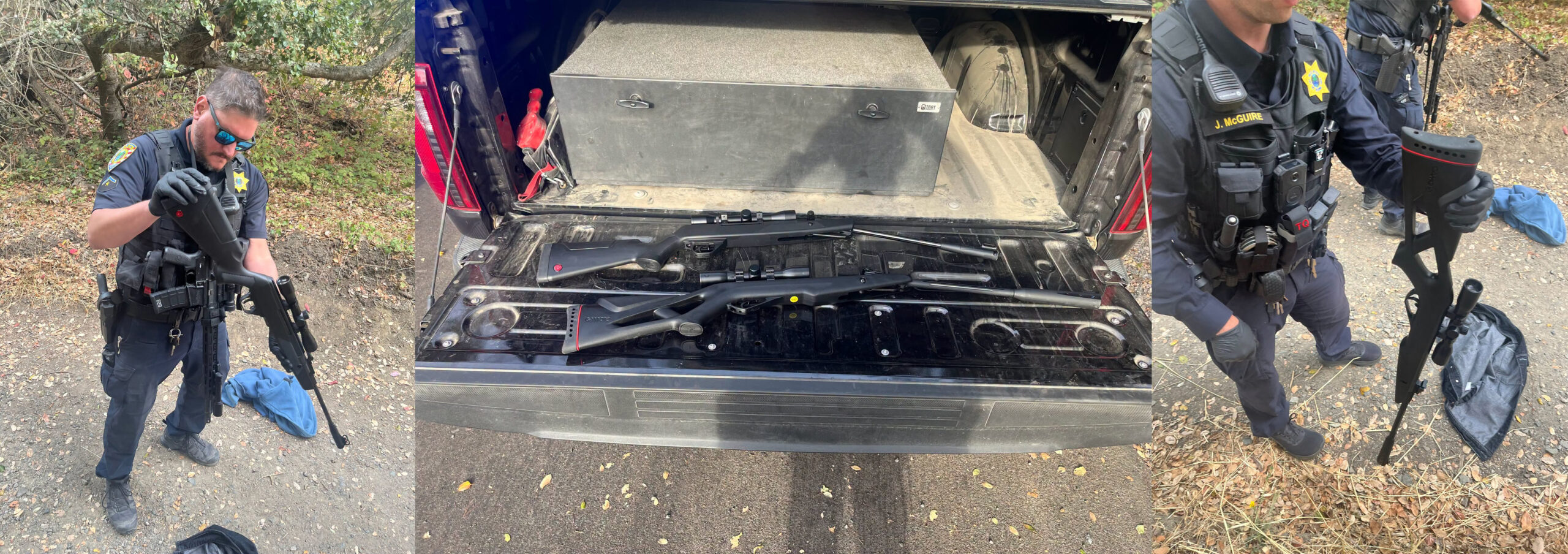
You can ensure you have an enjoyable Fourth of July Weekend in State Parks by following a handful of basic safety tips. Photos from California State Parks.

The California Department of Parks and Recreation, popularly known as State Parks, and the programs supported by its Office of Historic Preservation and divisions of Boating and Waterways and Off-Highway Motor Vehicle Recreation provide for the health, inspiration and education of the people of California by helping to preserve the state’s extraordinary biological diversity, protecting its most valued natural and cultural resources, and creating opportunities for high-quality outdoor recreation. Learn more at parks.ca.gov.


Filed Under: History, Holiday, News, Parks, State of California

Mount Diablo Initial Point’s 175th Anniversary to celebrate California’s surveying heritage July 18th

June 29, 2026 By Publisher Leave a Comment

The brass plate marks the Mount Diablo Initial Point inside the Visitor’s Center. Left source: Mount Diablo State Park. Right photo: The Center for Land Use Interpretation (CLUI)

Free historic public event commemorates one of the most significant survey monuments in the American West

By Mount Diablo State Park & Public Land Survey System Foundation

Join us on July 18, 2026, to commemorate a significant day in California mapping history.

On a hot summer day in 1851 Colonel Leander Ransom and his survey crew carried their equipment to the top of Mount Diablo and established the Mount Diablo Initial Point – the starting point for mapping property lines for much of California and all of Nevada.

Celebrate the 175th anniversary of the Initial Point with us…explore antique and modern surveying equipment, visit information booths, enjoy hands-on exhibits showcasing the science and practice of land surveying and activities designed to introduce younger visitors to the profession. Land surveyors and historians will be on hand to demonstrate equipment and answer questions about the history and significance of the Initial Point and Mount Diablo’s prominence. Guided tours will point out the original survey monuments housed inside the Summit Visitor Center.

with a day-long public celebration highlighting the history and enduring importance of one of the West’s most significant surveying landmarks.

The free educational event will be held from 10:00 a.m. to 4:00 p.m. at the Summit Upper Lot in Mount Diablo State Park. Visitors of all ages are invited to experience interactive exhibits, historical surveying demonstrations, educational presentations, and family-friendly activities that illustrate the vital role surveying has played in the development of California and Nevada.

According to The Center for Land Use Interpretation, the Mount Diablo Initial Point “is one of 37 federal survey points of origin covering the USA (outside of the 13 original colonies), known as Initial Points, selected over the course of 150 years, to anchor newly acquired federal land to the legal and cartographic grid.

“Most Initial Points are created incidentally, as baselines (and sometimes the meridians) are usually created first, with one end anchored on relatively immutable geographic features, such as the confluence of rivers, or latitudinal lines. The west has a number of exceptions, where prominent peaks were selected to be Initial Points, and then base-lines and meridians were drawn from them, as their visibility from great distances aided the surveyor’s task. Such was the case with Mount Diablo, an isolated mound rising above the surrounding valley, east of the San Francisco Bay area.”

A concrete column, built at the same time as the rest of the structure, sits atop the exposed bedrock of the summit and continues through the ceiling to a viewing gallery on the level above where it is topped with a brass plate. Photos: CLUI

“Mount Diablo has the most elaborate commemorative architectures of all the Initial Points. The building at the top of the mountain, built by the Civilian Conservation Corps in the 1930s, contains a small museum and encloses a monument built on top of the summit. The building itself extends the peak another 45 feet in elevation. A concrete column, built at the same time as the rest of the structure, sits atop the exposed bedrock of the summit and continues through the ceiling to a viewing gallery on the level above where it is topped with a brass plate. The rock of the actual summit is exposed at the base of the concrete column. An opening at the base of the column was provided to allow access to the exact spot from which the survey was conducted, marked now by a copper bolt head left from a 1876 triangulation station.”

The survey lines from Mount Diablo extend from the Pacific Ocean to Utah, and from Monterey Bay to Oregon, covering an area that includes most of California and all of Nevada (in green) and U.S. Meridians and Baselines map. Sources: (left) CLUI and (right) U.S. Dep’t of the Interior Bureau of Land Management

According to the Mount Diablo Surveyors Historical Society, “California has three initial points; Mount Diablo Base and Meridian (est. 1851) (center), San Bernardino Base and Meridian (est. 1852) (bottom), and Humboldt Base and Meridian (est. 1853) (top). Initial points are the starting points, and were established to describe and enable the government to sell public lands covering California and Nevada which were part of the Public Lands Survey System (PLSS).”

Visitors are encouraged to bring lunch, snacks, drinks and sunscreen and plan to spend the day enjoying the mountaintop setting while learning about one of California’s most enduring historical landmarks.

California State Parks, the Mount Diablo Surveyors Historical Society and Mount Diablo Interpretive Association are presenting this event and invite visitors to drop in between 10am-4pm at the Summit Visitor Center parking lot. Parking in this lot will be very limited. Please follow signs to park in the lower parking lot. There is a $10 per vehicle park entry fee, but no charge for the event.

For more information about the Public Land Survey System Foundation visit  www.plssfoundation.org.

Click for more information about Mount Diablo State Park or www.facebook.com/MountDiabloStatePark#.

Allen D. Payton contributed to this report.
 

Filed Under: Central County, History, News, Parks, Real Estate

Special free pass to California’s state historic parks in honor of Juneteenth and America’s 250th anniversary

June 19, 2026 By Publisher Leave a Comment

Source: California State Parks

SACRAMENTO — California is making the incredible sites that preserve the state’s complex history free to visit through a special limited-time pass.

California State Parks is offering a special edition Historian Passport free to download through the Fourth of July weekend. The Historian Passport (typical cost $50) is valid for the rest of 2026 at more than 30 state historic parks throughout California, where visitors can immerse themselves in the state’s unvarnished, complex history.

In celebration of Juneteenth and the 250th anniversary of the signing of the Declaration of Independence, Governor Gavin Newsom announced that California State Parks is offering a special free version of its Historian Passport — normally $50 for the year — for admission of up to four people per pass at more than 30 state historic parks throughout the state. Starting today through Monday, July 6, Californians can download the pass for free and use it for unlimited visits to participating historic parks from Juneteenth until the end of the year.

“California is marking these celebrations of freedom by inviting everyone to learn our country’s history for free in our state parks,” said Governor Newsom.

Coming on the heels of the fifth annual California State Parks Week, the limited-time free pass is the latest example of California expanding access to all Californians, giving more of them the opportunity to experience the unmatched natural and cultural resources of the nation’s largest and most diverse state park system, which includes historic sites significant to many peoples and cultures, including Native Americans. State Parks is embracing the state’s complex history through its Reexamining Our Past Initiative, working to tell the full story of how California came to be.

Supported by donations from the California State Parks Foundation and the California State Railroad Museum Foundation, the special edition of the Historian Passport highlights California’s rich and complex history through places that preserve stories of freedom, resilience, innovation, and community — including Colonel Allensworth State Historic Park, the most significant state park representing Black history in California. Participating parks span the state and showcase California’s diverse cultural, political, and social history, from Gold Rush-era communities and military landmarks to historic homes, missions and museums.

“California’s state historic parks preserve some of our nation’s most powerful and meaningful stories, and I’m proud to live in a state that celebrates diversity to connect more people with those stories through this limited-time free pass,” said California State Parks Director Armando Quintero. “I hope the free Historian Passport introduces more Californians to the state’s historic gems and sparks a curiosity, thirst for knowledge and sense of belonging that leads to many return visits. I thank Governor Newsom and the First Partner for their unwavering support of State Parks, and a special thanks to our partners, the California State Parks Foundation and the California State Railroad Museum Foundation, for supporting the free Historian Passport.”

“Juneteenth is a celebration of Black freedom, resilience, and the enduring pursuit of equality. For generations, Black Americans were excluded from public spaces and denied access to the opportunities and experiences that others enjoyed,” said State Senator Akilah Weber Pierson, M.D., Chair, California Legislative Black Caucus. “By widening access to California’s historic state parks to more families, we help ensure that public lands are places where everyone can learn and benefit from.”

The free pass builds on Governor Newsom’s State Parks Forward announcement on Earth Day, a bold effort to establish three new state parks — including a historic site near Bakersfield — and expand existing parks by more than 30,000 acres by the end of the decade. The announcement also follows Governor Newsom’s directive in January that more than 200 state parks offer free entry on Martin Luther King Jr. Day 2026.

Discover California Stories That Shaped the Nation

The California State Parks Historian Passport connects visitors to places that preserve the many cultures, communities, and defining moments that continue to shape California and the United States. Participating parks reflect stories of freedom, innovation, resilience and identity that continue to resonate today.

To visit the park sites, download your free special edition Historian Passport by July 6, and begin exploring California’s history firsthand. An account with ReserveCalifornia.com, State Parks’ official reservation service, is required to download.

Here are just a few parks passholders can access:

At Colonel Allensworth State Historic Park, visitors can explore a California town founded, financed, and governed by African Americans. Established in 1908 by Colonel Allen Allensworth and a group of Black pioneers, the state historic park stands as a powerful symbol of self-determination, opportunity and freedom, making it especially meaningful during Juneteenth commemorations.

At Indian Grinding Rock State Historic Park, visitors can view what is thought to be the largest collection of bedrock mortars in North America and one of the largest ceremonial roundhouse still used by Native Americans in California. Within the park, the Chaw’se Regional Indian Museum features a variety of exhibits and an outstanding collection of artifacts from tribes throughout the region.

At Marshall Gold Discovery State Historic Park, visitors can see the site where gold was discovered in 1848, sparking the California Gold Rush that dramatically transformed the state and nation. Visitors also learn the complex history of how the Gold Rush accelerated westward expansion, drawing people from around the world in pursuit of new opportunity, while acknowledging the hard history of violence toward and resilience of California Native Americans.

At Weaverville Joss House State Historic Park, visitors can experience the oldest continuously used Chinese temple in California. Built in the heart of a Gold Rush-era Chinese American community, the site reflects the enduring contributions, traditions and resilience of Chinese immigrants who helped build California despite widespread discrimination and exclusion.

These parks, alongside nearly 30 other participating state historic parks, invite Californians to explore the stories, struggles, and achievements that continue to shape our collective history. While there, visitors can take part in State Parks’ second annual Share Your Space Photo Contest through the OuterSpatial app.

“Building on our Outdoors for All initiative, we’re creating even more opportunities for Californians to explore the natural beauty and rich history that define our state. As we celebrate Juneteenth and our nation’s 250th anniversary, the free, special edition Historian Passport provides an incredible avenue for California families to immerse themselves in nature while gaining a deeper understanding of the remarkable place we’re proud to call home,” said Jennifer Siebel Newsom, the governor’s wife.

Making State Parks accessible for all

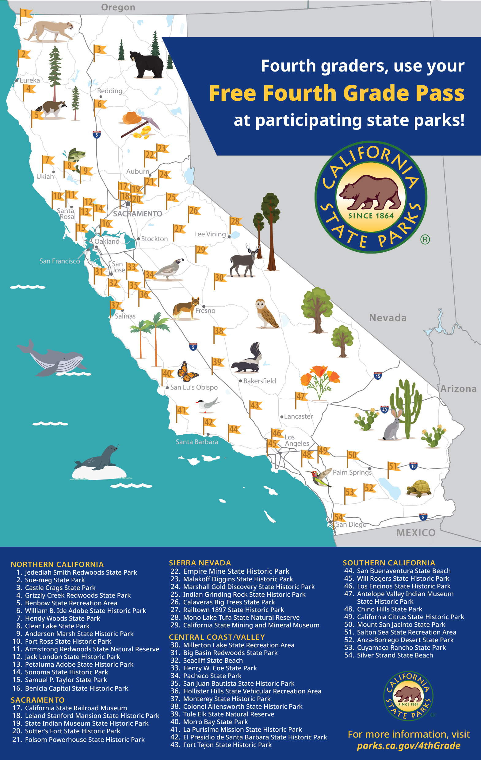
While this special edition Historian Passport is only available for a limited time, State Parks offers a number of free passes all year round in support of California’s Outdoors for All initiative. California residents from all walks of life — including families receiving public assistance, ALL fourth graders in public school, and anyone with a library card — can access free passes that open the nation’s largest and most diverse state park system and the unvarnished history of California to everyone.

  • California State Library Parks Pass: Allows library cardholders to check out a pass from any public library for free vehicle day-use entry at 200-plus state parks. It’s just like borrowing a book, with more than 33,000 passes available at over 1,100 public and tribal libraries in the state.
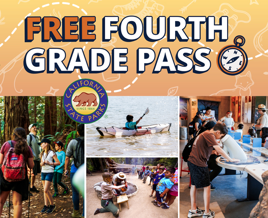
  • California State Parks Adventure Pass: Provides free entry to fourth-graders in public schools and their families at 54 amazing state parks. Download the pass and choose your adventure — mountains, deserts, forests, lakes.
  • Golden Bear Pass: This free annual pass provides vehicle day-use entry at over 200 state parks for families who receive CalWORKs, individuals who receive supplemental security income, income-eligible Californians over age 62, and participants of California’s Tribal Temporary Assistance for Needy Families (TANF) program.
  • Distinguished Veterans Pass: This free pass entitles honorably discharged California resident veterans to free vehicle day-use, family camping, and boat use at over 100 state parks. In addition, active, reserve, and retired military members receive free access on Memorial Day and Veterans Day.

State Parks protects the best of California’s natural and cultural history; more than 340 miles of coastline; the tallest, largest and among the oldest trees in the world; and deserts, lakes, rivers and beaches. There are more than 5,200 miles of trails, 15,000 campsites, 145,000 acres for off-highway vehicle recreation, plus prehistoric and historic archeological sites, ghost towns, historic homes and monuments – all waiting for you.

California State Parks and the recreational programs supported by its divisions of Boating and Waterways, Historic Preservation and Off-Highway Motor Vehicle Recreation provide the opportunity for families, friends, and communities to connect. Off-highway motor vehicle recreation, boating activities, horseback riding, cycling, hiking, camping, rock climbing, tours, hikes, school group enrichment, and special events are just some of the activities enjoyed in 280 park units organized into 21 field districts throughout the state. Learn more at www.parks.ca.gov.

Filed Under: News, Parks, State of California

East Bay Park District acquires 4.5 acres to add to Doolan Canyon Regional Preserve

June 18, 2026 By Publisher Leave a Comment

Map source: EBRPD

Land could serve as future staging area for potential public access

Preserve includes land in Contra Costa, Alameda counties

By External Affairs Division, East Bay Regional Park District

OAKLAND, Calif. — The East Bay Regional Park District has completed the purchase of 4.5 acres of land from the City of Livermore to add to Doolan Canyon Regional Preserve (the Preserve) in Livermore.

Although the Preserve is presently not open to the public, the newly acquired land could serve as a staging area and the first segment of a public trail if the Park District determines the Preserve can be open for public access. The property is located about a half mile south of the Preserve itself. Due to the Preserve’s hilly topography, creating an on-site staging area would not be cost-effective.

At its April 7 meeting, the Park District Board of Directors considered potential uses for the Preserve, including conservation only or a combination of conservation and public access. While no specific access plan option was adopted at the meeting, the Board voted to direct staff to begin developing a land use plan, which will include studies of the Preserve’s natural and cultural resources, site improvements, public access opportunities, and natural hazards. The Board also voted in favor of offering periodic guided tours of the Preserve while the land use planning process is underway over several years. The first opportunity will be in October 2026; details and reservation information will be released in the fall.

“Doolan Canyon Regional Preserve is one of the East Bay’s remarkable open space landscapes,” said the Park District’s Acting General Manager Max Korten. “As we begin the land use planning process, the Park District will carefully consider how to protect natural habitat while exploring opportunities for future public access.”

Livermore and the surrounding Tri-Valley communities have long recognized the importance of Doolan Canyon as a protected open space resource. This acquisition helps move the Park District closer to the possibility of opening the Preserve for public access and expanding recreation opportunities for residents of Livermore, Dublin, Pleasanton, and neighboring communities, while ensuring that planning is done thoughtfully and responsibly.

Background

Doolan Canyon Regional Preserve is an important natural and cultural landscape in the northern Livermore Valley. It has a rich agricultural history, with active cattle ranching today. The Preserve is located within the ancestral homeland of the Chochenyo-Ohlone speaking people, who are represented by a number of East Bay Ohlone tribes, and who reman connected to this landscape. Additionally, Doolan Canyon is home to important biological resources, which are culturally important to tribes.

Since the early 2000s, the Park District and the city of Livermore have worked together to protect and preserve Doolan Canyon. In 2010, the Park District and the city partnered to purchase 640 acres for the creation of Doolan Canyon Regional Preserve. An additional 160 acres was added to the Preserve in 2018. This new acquisition of 4.5 acres advances those shared goals and provides the Park District with an opportunity to develop a public staging area as it continues to evaluate potential uses.

About EBRPD

The East Bay Regional Park District is the largest regional park system in the nation, comprising 73 parks, 55 miles of shoreline, and over 1,330 miles of trails for hiking, biking, horseback riding, and environmental education. The Park District receives an estimated 30 million visits annually throughout Alameda and Contra Costa counties in the San Francisco Bay Area. For more information visit www.ebparks.org.

Filed Under: East Bay, News, Parks

Opinion: Forest Service reform must recognize recreation as essential program

April 7, 2026 By Publisher Leave a Comment

Courtesy of Don Amador

By Don Amador

The recent move by the U.S. Department of Agriculture to reorganize the U.S. Forest Service—including shifting key leadership functions out of Washington, D.C.—has sparked cautious optimism across both the powersports community and agency ranks.

For years, stakeholders—from tribes and counties to recreation groups and industry—have voiced the same concern: too much bureaucracy and not enough capacity in the field. The impact is tangible. Projects move slowly, fuels reduction lags, and recreation infrastructure—especially trails—falls behind maintenance needs.

Agency leads and field personnel are often tasked with delivering results while navigating increasingly complex processes with limited resources. The gap between policy and implementation has grown, and with it, frustration on all sides.

If done right, it could mark a long-overdue shift—moving resources, authority, and accountability closer to the landscapes and communities where they are needed most. The USDA’s emphasis on “common-sense forest management” suggests a renewed focus on active management, wildfire resilience, and getting projects across the finish line.

For the powersports community, this is not an abstract policy debate. Access depends on capacity. When field offices are understaffed or under-resourced, trails degrade, maintenance backlogs grow, and opportunities for collaboration are lost. When resources are aligned with field delivery, the opposite happens—projects move forward, partnerships strengthen, and access improves.

There is also a unique opportunity right now. The direction of this reorganization aligns with long-standing recommendations from stakeholders: streamline bureaucracy, empower field staff, and focus on outcomes. Across the West, collaborative models—tribal co-stewardship, stewardship contracting, and recreation partnerships—are already proving what works.

To succeed, it must go beyond structural change. It needs to continue shifting real resources to the field, empower local decision-making, and recognize recreation as essential infrastructure—not an afterthought.

See Forest Service news release on reorganization.

Don Amador has been in the trail advocacy and recreation management profession for 35 years.   Don is President of Quiet Warrior Racing LLC. Don serves as the Western States Representative for the Motorcycle Industry Council. Don is Past President/CEO and current board member of the Post Wildfire OHV Recovery Alliance.  Don is a Co-Founder and Core-Team member on FireScape Mendocino, a forest health collaborative that is part of the National Fire Learning Network.  Don served as an AD Driver for the Forest Service North Zone Fire Cache during the 2022, 2023, and 2024 Fire Seasons.  


Filed Under: Opinion, Parks, Recreation

Rep. DeSaulnier advances over $46.7 million for local projects in Contra Costa, Alameda counties

April 1, 2026 By Publisher Leave a Comment

Budget requests for infrastructure, transportation, community development, public and environmental health and safety

$10 million for Vasco Road safety & mobility improvements

By Mairead Glowacki, Communications Director, Office of Congressman Mark DeSaulnier

Washington, D.C. – Today, Congressman Mark DeSaulnier (CA-10) announced that he advanced over $46.7 million for 20 projects to benefit Contra Costa and Alameda Counties for consideration by the U.S. House Committee on Appropriations as part of the Fiscal Year 2027 appropriations process. These projects would help to improve quality of life for the people of California’s 10th Congressional District by upgrading infrastructure and transportation accessibility and increasing public and environmental safety.

“Simply put, my number one priority in Congress is to make life better for the people I represent, and the $46.7 million we are advancing will help to do just that by investing in safety and easing congestion for drivers, bikers, and pedestrians alike, housing, emergency preparedness, crime prevention, and more,” said DeSaulnier. “I am continuously grateful to our local governments and organizations for their thoughtful project submissions, and I look forward to fighting to see the projects through the legislative process to bring this important funding home.”

Infrastructure Upgrades, Transportation Accessibility, and Community Development Projects:

  • $5,000,000 for the County of Contra Costa to design a new roadway connection that will improve regional mobility between Contra Costa and San Joaquin Counties using a connector route that shifts interregional traffic from Byron Highway and local roads in the Town of Byron to Vasco Road, to accommodate higher traffic volumes.
  • $5,000,000 for the County of Contra Costa to construct safety countermeasures along a 12.1-mile segment of Vasco Road between Marsh Creek Road and the Alameda County line in unincorporated Byron, California to decrease the number of accidents on this busy thoroughfare.
  • $4,000,000 for the City of Brentwood to construct infrastructure and site improvements to prepare a site to house the Brentwood Agricultural Technology Innovation Center.
  • $2,800,000 for the City of Lafayette to construct the Brown Avenue to Pleasant Hill Road segment of the Aqueduct Pathway, a fully accessible Class I separated bicycle and pedestrian facility located within the East Bay Municipal Utility District (EBMUD) aqueduct corridor in downtown Lafayette, California.
  • $2,000,000 for East Bay Regional Park District to construct a dedicated bus staging and drop-off area designed to accommodate regional transit agencies and other visitors, and remove aging rail infrastructure to replace it with accessible, multi-use pathways as part of the second phase of a project to allow for the Thurgood Marshall Regional Park to be opened up to the public.
  • $2,000,000 for the City of Lafayette to construct a 48-unit development of supportive and affordable housing for individuals with intellectual and developmental disabilities.
  • $2,000,000 for the City of San Ramon to continue buildout and close gaps in the citywide fiber optic network supporting transportation operations, public safety, and future smart city technologies.
  • $1,750,000 to the City of Walnut Creek to install a new traffic signal at the intersection between Treat Boulevard and Arkell Road in Walnut Creek, California, which is currently controlled by stop signs.
  • $1,500,000 for the County of Contra Costa to construct separated wheeled (bicycle, e-bike, and scooter) and pedestrian pathways in the Iron Horse Corridor from Bollinger Canyon Road to Crow Canyon Road in the City of San Ramon to separate wheeled and pedestrian modes and improve user safety.
  • $1,300,000 for the County of Contra Costa to construct a new youth center in Brentwood, California that will provide academic counseling and employment training in the culinary field.
  • $1,296,000 for the City of Orinda to complete pavement rehabilitation work and widening on the Camino Pablo Pathway in Orinda, California to expand and maintain aging infrastructure that currently sees heavy pedestrian use.

Public and Environmental Health and Safety:

  • $5,000,000 for the City of Concord to make improvements to the City of Concord’s Emergency Operations Center (EOC) to ensure that it can continue to function as a critical hub for regional preparedness, response, and recovery efforts during emergencies and disasters.
  • $3,150,000 for Central Contra Costa Sanitary District to add Densified Activated Sludge (DAS) technology to Central San’s existing large-scale Membrane Aerated Biofilm Reactor (MABR) demonstration site and share results with wastewater agencies across the region. DAS and MABR are complementary, cutting-edge technologies that could enhance nitrogen removal and environmental protection while leveraging existing treatment facilities.
  • $2,000,000 for the City of San Ramon to replace the Police Department’s aging Records Management System (RMS), associated software, and supporting equipment. The project will modernize the City’s public safety technology infrastructure by implementing a next-generation RMS, preserving and migrating existing police records, and integrating with electronic files. The project may also incorporate a unified interface that allows officers and investigators to securely access data from multiple regional law enforcement systems within a single platform, improving efficiency, and reducing the need to switch between separate applications.
  • $1,800,000 for the County of Contra Costa to build two mobile communications sites to enhance the resiliency of first responder radio communications in the event of a natural disaster or other widespread threat.
  • $1,684,990 for the City of Antioch to establish a Real-Time Operations Center (RTOC) to serve as the Antioch Police Department’s central hub for intelligence and information-sharing, integrating existing technologies—including gunshot detection, public safety cameras, and Computer-Aided Dispatch (CAD)—into a unified, citywide system that enhances crime monitoring, investigative efficiency, and officer response.
  • $1,650,000 for the County of Contra Costa to expand Contra Costa County’s ability to prioritize and investigate unsolved nonfatal and fatal violent crime, prevent future crimes, and enhance victim/witness safety through coordinated, data driven investigations, focused prosecution, and survivor support services.
  • $1,000,000 for the City of Orinda to maintain and improve the North Orinda Shaded Fuel Break to reduce the probability of catastrophic fire spread while improving firefighter access and operational effectiveness, specifically by maintaining previously treated areas, conducting hazard tree identification and abatement, and expanding interagency coordination.
  • $936,930 for the Town of Moraga to replace and upgrade existing police radios, a combined total of 65 handheld portable radios and 44 vehicle mounted mobile radios, used by the Lafayette, Moraga, and Orinda police departments.
  • $923,000 for Mt. View Sanitary District to initiate pump station and collection systems upgrades by studying the root causes of system stress and the most efficient and effective repair methods.

“For over 135 years the Iron Horse Trail has connected communities in Contra Costa, with the railroad running from 1891-1978, followed by its use as the much-beloved pedestrian and bicycle trail we enjoy today. This $1.5 million investment in the Iron Horse Trail Double Tracking Pilot is about improving safety and enhancing its use as an active transportation corridor. Creating trail separation allows pedestrians to enjoy their walks on the trail without safety concerns related to faster moving bikes. Bicyclists will be able to use their separated bikeway to get to and from work, school, and transit centers more efficiently,” said Candace Andersen, Contra Costa County Supervisor (District II).

“We are deeply grateful to Mark DeSaulnier for selecting the Downtown Aqueduct Pathway Project for Community Project Funding consideration. The Congressman’s support is instrumental in helping Lafayette advance a transformative project that will create a safe, continuous, and car-free route between neighborhoods, downtown destinations, and regional transit,” said Carl Anduri, Mayor of Lafayette.

“We are deeply grateful to have the Congressman’s support of these projects, which reflect San Ramon’s commitment to modernizing critical infrastructure, enhancing public safety, and investing in technology that improves the daily lives of our residents,” said Mark Armstrong, Mayor of San Ramon. “We value the Congressman’s continued partnership and advocacy on behalf of the San Ramon community and appreciate the opportunity to advance to Committee review of these transformative investments that will strengthen mobility, resilience, and public safety citywide.”

“Thank you to Congressman DeSaulnier for championing innovative solutions to one of the Bay Area’s most critical regulatory challenges: reducing nitrogen discharges to the Bay while keeping costs manageable for wastewater customers. The MABR and DAS Bay Area Regional Demonstration Site will advance technologies aimed at better protecting our beautiful Bay, while potentially saving billions of dollars across our region and beyond. We’re grateful for Congressman DeSaulnier’s vision, leadership, and commitment to clean water infrastructure that benefits our communities and the environment both now and, in the future,” said Roger Bailey, General Manager of the Central Contra Costa Sanitary District.

“Thank you to Congressman DeSaulnier for his leadership and support in strengthening community safety and supporting survivors of violence. The Contra Costa Unsolved Violent Crime & Victim Safety Initiative expands the county’s ability to prioritize and investigate unsolved shootings and increase clearance rates – which is the percentage of crimes that result in an arrest or other official resolution. Moreover, the initiative pairs data-driven investigations with survivor-centered services to keep victims and witnesses safe, rebuild community trust, and make sure families affected by violence received the justice and attention they deserve,” said Diana Becton, Contra Costa County District Attorney.

“We appreciate Congressman DeSaulnier for championing investments that expand opportunities for young people in East County. The Brentwood Youth Center Project will create a new 15,000 square foot facility offering culinary training in healthcare, culinary arts and skilled trades, academic support, and mental health counseling spaces—providing local youth with safe, modern, and accessible resources right in their community. This project strengthens workforce development into career pathways, supports whole person development, and ensures Brentwood’s young residents have the tools they need to thrive,” said Tamia Brown, Executive Director, Contra Costa County Workforce Development Board.

“On behalf of Contra Costa County, I want to thank Congressman DeSaulnier for his steadfast support of Contra Costa County projects that will provide wide-benefits to the community—from transportation safety improvements on Vasco Road and the Byron Highway, to critical investments in youth development, public safety communications, and solutions that strengthen justice for victims and families. His continued partnership ensures we can deliver safer roads, stronger emergency response, expanded youth opportunities, and improved community safety for residents across all of Contra Costa and beyond. We are deeply grateful for his leadership and his commitment to bringing meaningful federal resources home to Contra Costa,” said Diane Burgis, Chair of the Contra Costa County Board of Supervisors.

“We are grateful to Representative DeSaulnier and his team for their support of this critical wastewater infrastructure work,” said Lilia Corona, Mt. View Sanitary District General Manager. “The Next-Generation Pump Station and Collection System Projects will bolster the process of replacing equipment at the end of its service life. We’re excited by this major step forward for sanitary operations in Contra Costa County, which will allow Mt. View Sanitary District to continue delivering exceptional service quality to our customers.”

“We are grateful to Congressman DeSaulnier for supporting these important infrastructure and wildfire mitigation projects. The Camino Pablo Pathway will enhance pedestrian mobility and connect key parts of our community, while the North Orinda Shaded Fuel Break will significantly reduce wildfire risk and strengthen emergency response capabilities across the broader Lamorinda region. These projects represent critical investments in Orinda’s safety, sustainability, and quality of life,” said Brandyn Iverson, Mayor of Orinda.

“We are grateful for the support of Congressman DeSaulnier in advancing the Lamorinda Public Safety Radio Replacement project for funding.  Through replacing and upgrading the radios used by the Lafayette, Moraga and Orinda Police Departments, this project will enhance public safety throughout the region and ensure that law enforcement officers are equipped to address emergency situations, evacuations, and other critical incidents. Congressman DeSaulnier’s efforts are helping to keep our communities and law enforcement officers safe with this critical investment in public safety communications equipment,” said Jon King, Chief of Police for the Moraga Police Department.

“Thank you to Congressman DeSaulnier for supporting our community’s continued efforts to make Vasco Road safer for all who rely on it. The Vasco Road Safety Improvements – Phase 3 Project delivers targeted, community‑supported safety upgrades along the corridor, including proven Federal Highway Administration countermeasures designed to reduce collisions and improve visibility. These improvements will help protect commuters and enhance regional mobility along this critical East County route,” said Warren Lai, Director of Public Works, Contra Costa County.

Lai continued, “We are grateful to Congressman DeSaulnier for his continued leadership and support of vital East County transportation investments. The Vasco Road–Byron Highway Connector Project will reduce cut-through traffic in Byron, improve regional mobility between Contra Costa and San Joaquin counties, and enhance safety by providing a more efficient route for commuters and goods movement. This project represents an important step toward long term connectivity and economic opportunity for the region.”

“We are grateful to Congressman DeSaulnier for advancing Antioch’s Real-Time Operations Center project for federal consideration. This investment reflects the kind of forward-looking public safety infrastructure cities need to serve growing communities, improve coordination across government functions, and deliver smarter, more effective services to the public,” said Bessie Marie Scott, Antioch City Manager.

“Brentwood has a robust agricultural history, and a long-standing legacy of providing fresh produce and products from our locally-owned farms to tables across America. This funding investment represents the next chapter in this story and the future of farming. The Agricultural Technology Innovation Center will bring together agriculture, education, and technology to create jobs, support workforce development, and strengthen our nation’s food systems. Federal investment in critical infrastructure is the key to unlocking this opportunity, and we are grateful for Congressman DeSaulnier’s leadership and vision in advancing a project that delivers both regional and national impact,” said Susannah Meyer, Mayor of Brentwood.

“We are grateful to Congressman DeSaulnier for his strong support of Concord’s Emergency Operations Center upgrades. This investment strengthens our ability to protect residents, coordinate a regional response, and ensure our community is prepared when it matters most,” said Laura Nakamura, Mayor of Concord.

“Thank you to Congressman DeSaulnier for his commitment to strengthening public safety and emergency response across the East Bay. The East Bay Regional Communications System – Mobile Communications Sites on Wheels Project will provide deployable, towable mobile towers that ensure backup radio coverage during disasters, domestic terrorism, or large-scale incidents—significantly enhancing the resiliency, reliability, and interoperability of communications for first responders in Contra Costa and Alameda counties. This investment ensures that when emergencies strike, our communities and safety personnel can rely on a stable, redundant system that keeps critical communications operational when they’re needed most,” said David Swing, Executive Director of the East Bay Regional Communications Authority.

“The City of Walnut Creek greatly appreciates Congressman DeSaulnier’s leadership and continued support in advancing safety for our residents. This critical infrastructure project for a new traffic signal will improve the efficiency of regional traffic, emergency vehicle response times, and safety for all modes of transportation,” said Kevin Wilk, Mayor of Walnut Creek.

Selection and submission of projects to the Appropriations Committee is the first stage of the process for Community Project Funding. Each project submitted must meet the criteria set forth by the Committee, which can be found here, and must then be passed in the Committee and by both the House and Senate before it becomes law. The projects are subject to a strict transparency and accountability process, which is detailed here by the Appropriations Committee. Examples of this vetting include certifying that Members have no financial interest in these projects, an audit of a sampling of these projects by the Government Accountability Office, and a requirement for demonstrated community support and engagement for each submission. More information on each project and the certifications of no financial interest can be found here.


Filed Under: Environment, Finances, Government, Infrastructure, Legislation, News, Parks, Police, Transportation

Save Mount Diablo expands free Discover Diablo hikes, outings program for 2026

February 10, 2026 By Publisher Leave a Comment

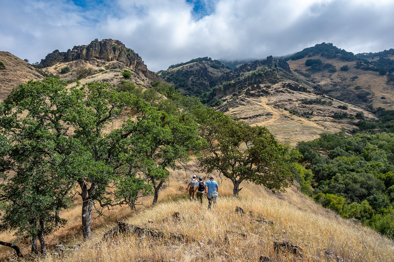
Discover Diablo Exploratory hike in Del Puerto Canyon. Photo: Kendra Smith. Inset – People enjoying our Discover Diablo hike looking for newts at Briones Regional Park. Photo: Emily Sherwood.

By Laura Kindsvater, Senior Communications Manager, Save Mount Diablo

CONTRA COSTA, ALAMEDA, STANISLAUS AND SAN BENITO COUNTIES—Explore some of the East Bay’s premiere hiking and natural areas with Save Mount Diablo in 2026, including places normally closed to the public.

The Discover Diablo outings series offers guided hikes, themed walks, and other outdoor activities: mountain biking; rock climbing; meditation in nature; plein air painting events; and property tours.

New this year are a Green Ranch rove, and a Spanish language hike at Pine Canyon.

We’ll also be continuing much-loved events in 2026 including rock climbing at Mount Diablo State Park and Pinnacles National Park, stargazing with the Mount Diablo Astronomical Society, our Mitchell Canyon medicinal herb walk, Pinnacles condor hikes and our tarantula treks!

Save Mount Diablo is offering a total of 36 more excursions in 2026 in Contra Costa County (Walnut Creek, Clayton, Concord, Pittsburg, Antioch, Brentwood, Oakley, Danville, and San Ramon), Alameda County (Dublin, Livermore, and Pleasanton), Stanislaus County (Patterson), and San Benito County (Hollister and San Juan Bautista). All events are free to the public. Trailblazers of all ages and skill levels are welcome to choose appropriate outings from our extensive offerings.

The Discover Diablo program began in 2017 to connect local communities to the spectacular natural world of the Mount Diablo area and to build awareness about land conservation.

Hikes and outings take place at Save Mount Diablo’s conserved properties or on park lands in the Diablo Range. These include Mount Diablo State Park, East Bay Regional Park District, Walnut Creek Open Space Foundation, Contra Costa Water District, Stanislaus County Parks, and National Park Service lands.

Discover Diablo hikes are guided by experts steeped in the natural history and lore of the region, who both educate and entertain while emphasizing the breathtaking beauty that the Diablo Range has to offer.

Save Mount Diablo hopes the Discover Diablo series will spark a passion for the Diablo Range and deepen people’s connections to the land and nature.

Ted Clement, Executive Director of Save Mount Diablo, stated, “It is the goal of the Discover Diablo program to build connections between people, Save Mount Diablo, and the land, helping our communities develop a strong sense of place and a deepened appreciation for our collective backyard. Most importantly, we want to cultivate a love of the land in participants, as that is what it will take to ensure the precious Diablo natural areas are taken care of for generations to come.”

There is something right for anyone to discover in the nooks and crannies surrounding Mount Diablo and within its sustaining Diablo Range, so be sure to hit the trails in 2026 and find your own individual inspiration!

RSVPs required. To ensure everyone has an equal opportunity to attend, registration for hikes and outings will open one month prior to each hike’s date. See our schedule of upcoming hikes and outings; view and RSVP online here: https://savemountdiablo.org/what-we-do/educating-and-inspiring-people/discover-diablo-hikes-outings/

Filed Under: Bay Area, News, Parks, Recreation

East Bay Park District remembers Doug McConnell

January 16, 2026 By Publisher Leave a Comment

Doug McConnell. Source: EBRPD

Honoring Bay Area journalist’s legacy of connecting people to Nature

By EBRPD Public Affairs

East Bay Regional Park District staff are deeply saddened by the passing of Doug McConnell, beloved longtime host of OpenRoad with Doug McConnell on NBC. Doug’s storytelling helped raise public awareness of the value of parks, trails, and community conservation efforts across Northern California and beyond, making outdoor exploration accessible and meaningful to a wider audience.

Source: OpenRoad Facebook page

A post on the OpenRoad with Doug McConnell Facebook page on Thursday, Jan. 15, 2026, shares more details about his passing. It reads, “It is with heavy hearts and deep sadness that we share the news that Doug McConnell peacefully passed on the night of January 13th, 2026. Since his stroke in the fall of 2023 he had bravely struggled to regain his health, but a string of setbacks finally caught up with him. Doug was our friend, mentor, and a guiding light along our own life journeys. We will miss him dearly and wish his family peace in this difficult time.

Doug dedicated much of his life to telling stories about the world’s beautiful natural places and encouraged everyone to enjoy them and especially to protect them. He made friends wherever he went. He was the best road trip companion you could have, the biggest optimist we ever met, a human GPS with a steel trap memory, friendly to a fault, knowledgeable about most any subject, and filled the world with enthusiastic positivity. We affectionately described him as the human golden retriever.

No words in a social media post can adequately convey what Doug has meant to us. If he meant something to you. If his TV shows resonated with you. If you have a story about him you’d like to tell, please feel free to tell it here. We’d love to hear from you about what Doug meant to you.

We loved Doug and will miss him dearly.”

The Park District worked with Doug McConnell and his crew many times over the past three decades to showcase East Bay Regional Parks, first on Bay Area Backroads and followed by his most recent show, OpenRoad. Together, we helped educate viewers about the importance of spending time in nature and the role conservation plays in ensuring future generations have the same opportunity. He was a thoughtful journalist whose commitment to community, collaboration, and public service left a lasting impact on the East Bay. We are grateful for his dedication and the positive spirit he brought to his work.

Doug first began working with the Park District in 1993, and this creative collaboration has continued through present day. Through this work, he became an integral part of the Park District’s history, working closely with District staff on many projects. Doug was master of ceremonies at the District’s 65th and 75th anniversary events, Regional Parks Foundation signature events, and the Healthy Parks, Healthy People festival.

In a Jan. 14 statement issued by the OpenRoad team, his colleagues said, “Doug was grateful that his legacy continues, a legacy of joyfully encouraging everyone to explore and appreciate the beauty and diversity of our natural lands, and to celebrate the work so many of you are doing to restore and protect these natural places.” The Park District is honored to be included in Doug’s work and legacy.

Notable episodes featuring the Park District include:

Regional Parks Foundation Legacy on OpenRoad (2018)

East Bay Regional Parks For All (2019)

The East Bay Regional Parks Respond to COVID-19 (2020)

This special episode filmed during the COVID-19 pandemic showed how the Park District responded to the crisis and how parks provided an essential service for physical health and mental well-being.

Additional COVID-related collaborations with Doug included Park District public service announcements, local public health agency messages, and Parks Are Essential multi-agency messaging to promote spending time in nature.

Exploring the Rebirth of East Bay Regional Parks (2021)

The Legacy of the East Bay Regional Parks District (2022)

The Most Visited Park District in California (2023)

The East Bay Regional Park District is the largest regional park system in the nation, comprising 73 parks, 55 miles of shoreline, and over 1,330 miles of trails for hiking, biking, horseback riding, and environmental education. The Park District receives an estimated 30 million visits annually throughout Alameda and Contra Costa counties in the San Francisco Bay Area.

Filed Under: East Bay, Journalism, News, Parks, People

  • 1
  • 2
  • 3
  • …
  • 16
  • Next Page »
RepublicServices-Antioch-ad (1)
Monica's dinner 05-26 CCH
Delta-RC-B 07-26
Deer-Valley-Chiro-06-22

Copyright © 2026 · · Contra Costa Herald · All Rights Reserved